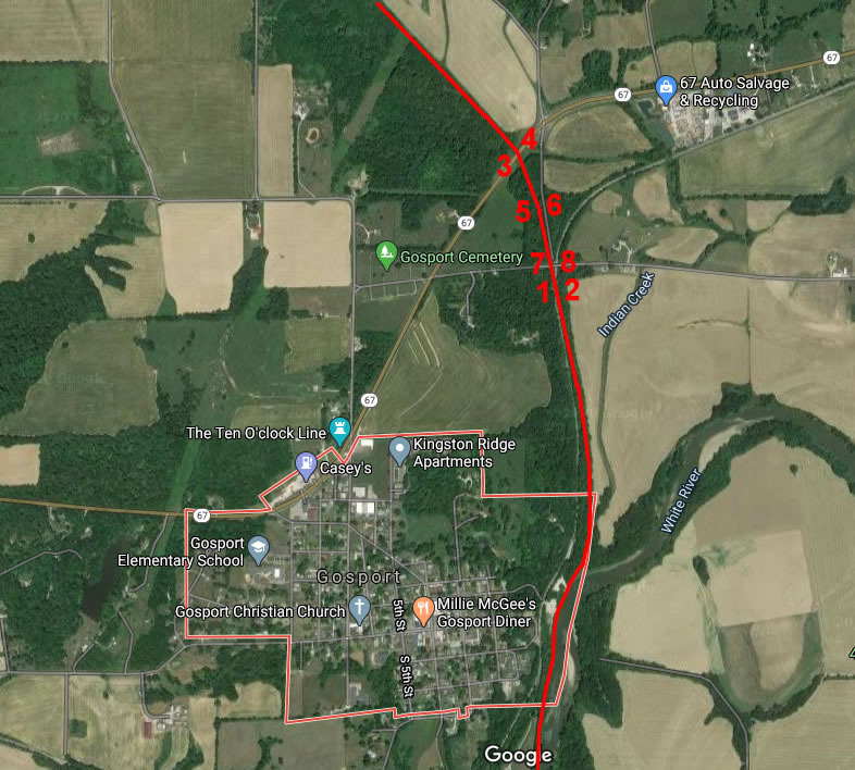
Google map 2020
Gosport Junction
Gosport, IN
Nathan Miles Photos 2020
MONON Railroad in red
Click on the number on
the map to see the picture of that area.
Descriptions are to the right.

| Back |
1: Taken from the MON-PRR diamond location. Looking north toward Chicago.
2: The MON-PRR diamond location. Looking south toward Louisville.
3: Taken from the State Road 67 bridge. Looking north toward Chicago.
4: The State Road 67 bridge. Looking south toward Louisville.
5: Taken from the County Road 600 East crossing. Looking north toward
6: The County Road 600 East crossing. Looking south toward Louisville.
7: Taken from the Lingle Road bridge. Looking north toward Chicago.
8: The Lingle Road bridge. Looking south toward Louisville.