Google map 2022
Stinesville Area
Nathan Miles Photos 2022
MONON Railroad in red
Click on the number on
the map to see the picture of that area.
Descriptions are to the right.


| Back |
1: The depot would have been right where the pickup truck is now parked, and I would be standing on the tracks. Looking south towards Louisville.
2: This nice little display was presumably made by a local, and placed next to the ROW at the corner of Main Street and North Railroad Street.
3: Looking across what's left of Bridge 207.7, just north of town. Looking north towards Chicago.
4: The other side of Bridge 207.7. Looking south towards Louisville.
5: And a side view of Bridge 207.7, taken from the parallel and appropriately named North Railroad Street.
6: Looking across what's left of Bridge 208.0, just south of town. I was unable to reach the other side of this one, unfortunately. Looking south towards Louisville.
7: Taken from the North Texas Ridge Road crossing on the north outskirts of Stinesville. Looking north towards Chicago.
8: The North Texas Ridge Road crossing on the north outskirts of Stinesville. Looking south towards Louisville.
9: Taken from the Main Street crossing. Looking north towards Chicago.
10: The Main Street crossing. Looking south towards Louisville.
11: Taken from the West Walnut Street crossing. Looking north towards Chicago.
12: The West Walnut Street crossing. Looking south towards Louisville.
2d Map Below
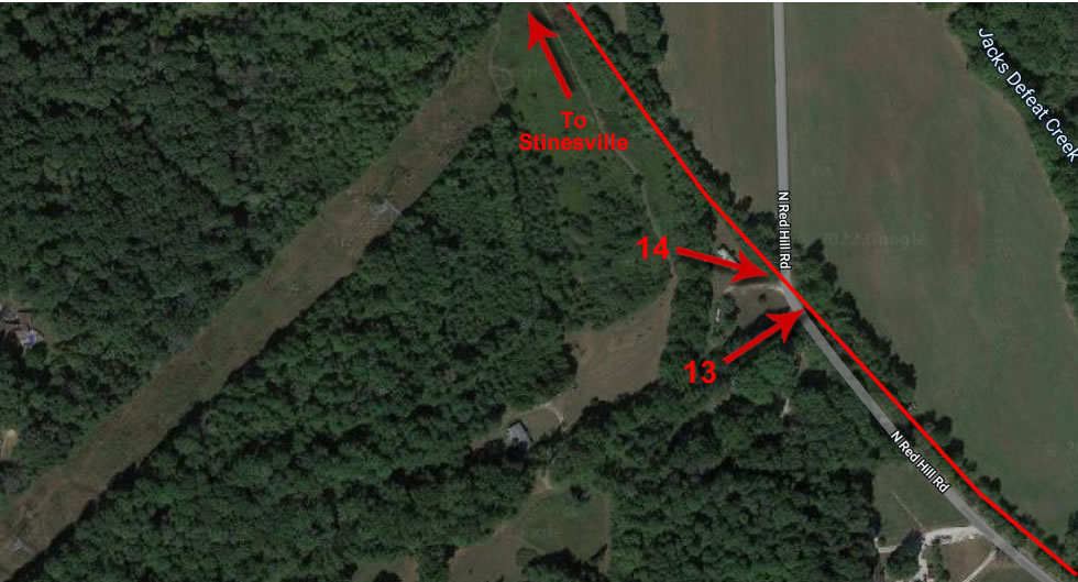
13: Taken from the North Red Hill Road crossing on the south outskirts of Stinesville. Looking north towards Chicago.
14: The North Red Hill Road crossing on the south outskirts of Stinesville. Looking south towards Louisville.