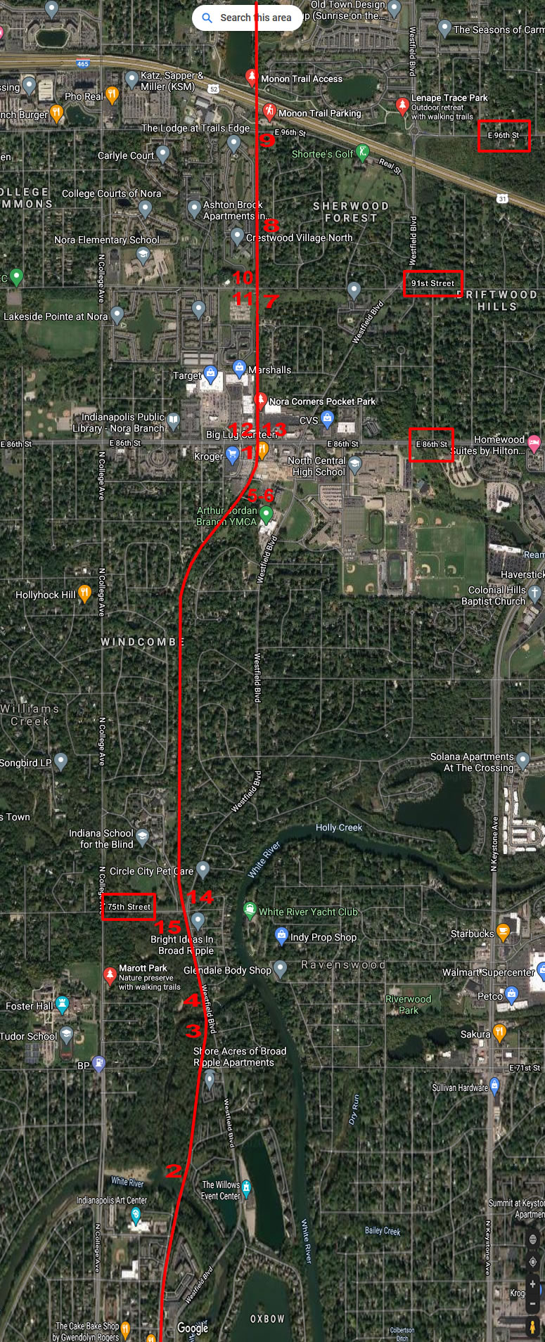
Google map 2020
Nora, IN Area
Nathan Miles Photos 2020
MONON Railroad in red
Click on the number on
the map to see the picture of that area.
Descriptions are to the right.

| Back |
1: An info plaque just south of East 86th Street that discusses the history of Nora and the rail line that ran through it. Also, has anyone seen a dog?
2: Taken from the north side of Bridge B174.8 across the White River. Looking south toward Union Station.
See also Pic 11 in the Broad Ripple picture set.
3: Taken from the south side of Bridge B174.3. Looking north toward Chicago.
4: Taken from the north side of Bridge B174.3. Looking south toward Union Station.
5: Some ties from a long-abandoned second track are still visible on the east side of the trail just north of the connecting walkway to the Arthur Jordan YMCA. Looking north toward Chicago.
6: Another angle of the ties. Could this be where the Nora depot was? It wouldn't be the grain elevator, the picture on the plaque in 1 (also at the top of the page) shows it being on straight track, and these ties are on the S-curve south of East 86th Street. Looking south toward Union Station.
7: An old signal mounting on the east side of the tracks just south of East 91st Street. I believe this would be Signal B171.8.
8: A pair of several telegraph poles on the west side of tracks that still stand in Nora. These two are a bit south of East 96th Street, but there were several more between here and Bridge B174.8 that aren't in as good condition and/or overgrown to the point of being hard to find. Looking north toward Chicago.
9: Taken from the East 96th Street crossing. Looking south toward Union Station.
10: Taken from the East 91st Street crossing. Looking north toward Chicago.
11: The East 91st Street crossing. Looking south toward Union Station.
12: Taken from the East 86th Street crossing. Looking north toward Chicago.
13: The East 86th Street crossing. Looking south toward Union Station.
14: Taken from the East 75th Street crossing. Looking north toward Chicago.
15: The East 75th Street crossing. Looking south toward Union Station.