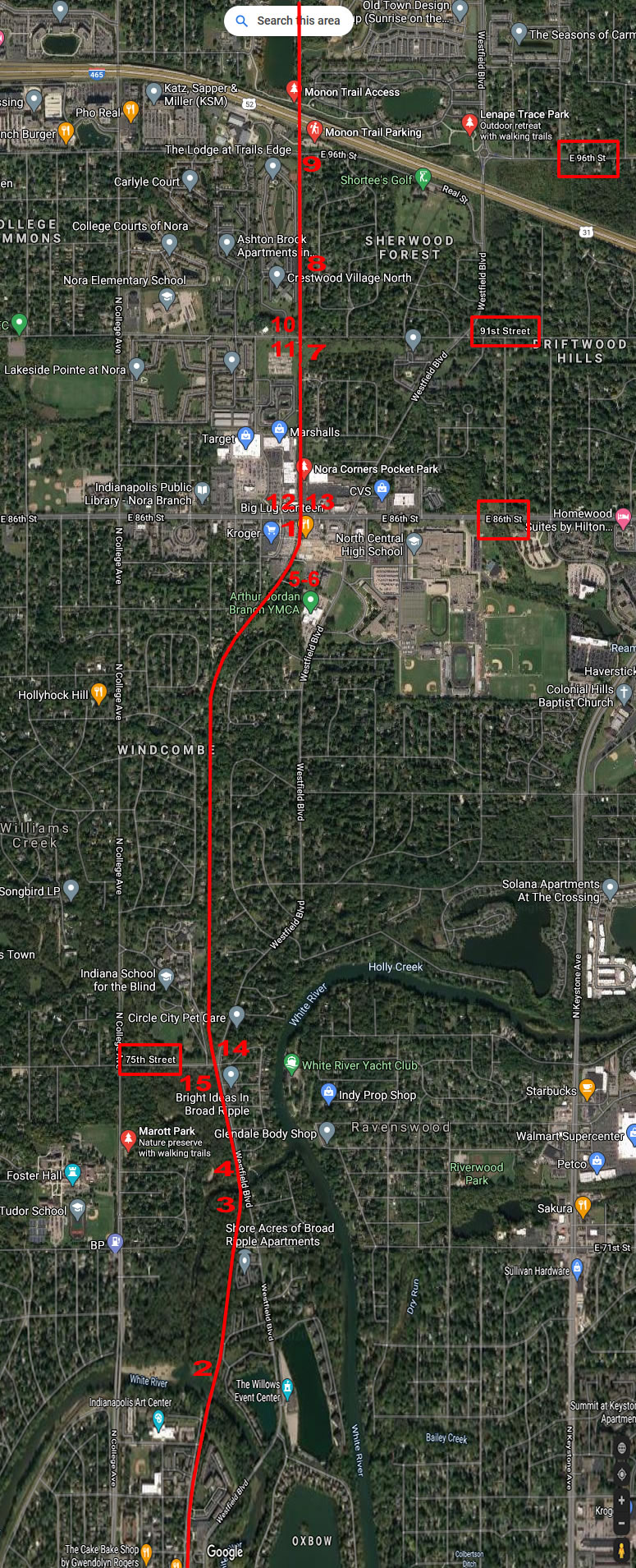
|
MP 172.4 2nd Subdivision -
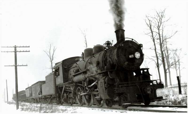
Steam locomotive #413 working local switching near Nora, 1946. (Editor's Note: We are not 100% certain this location is Nora, but it was indicated near Nora on the photograph.)
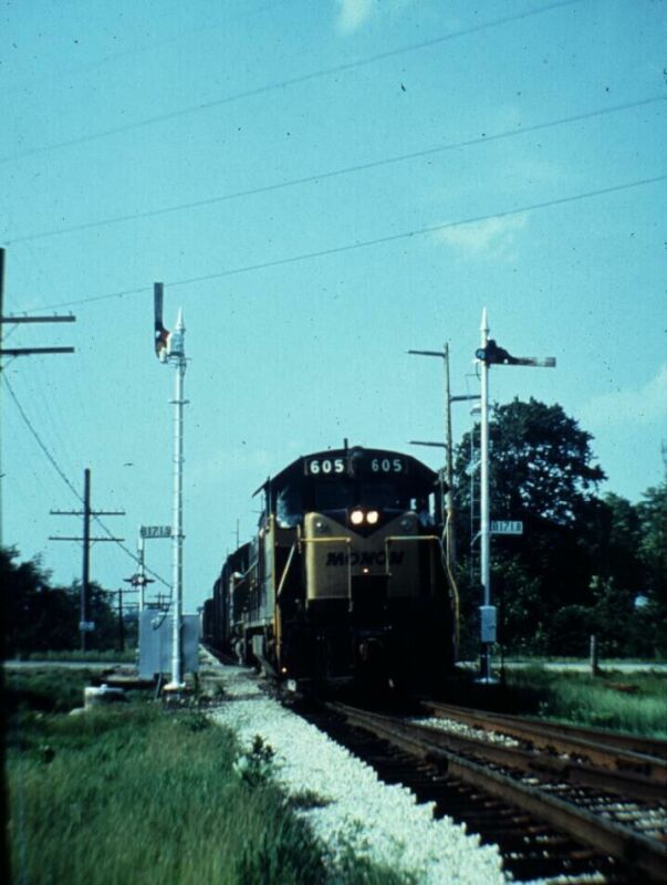
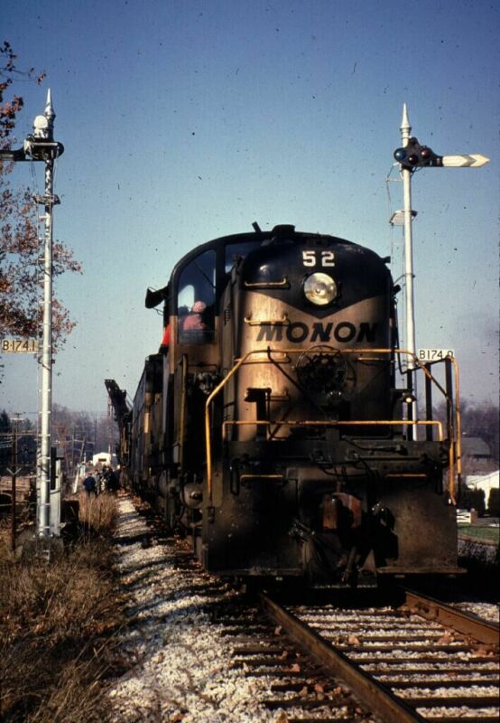
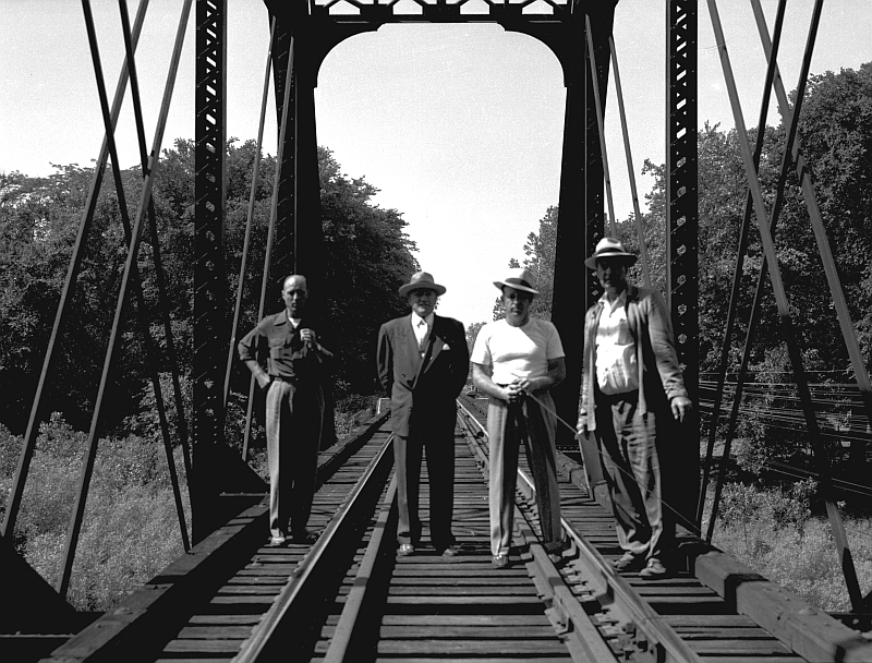
Left and Right: Milepost B171.8, Nora. Wreck train working to clear a derailment, December 1969.
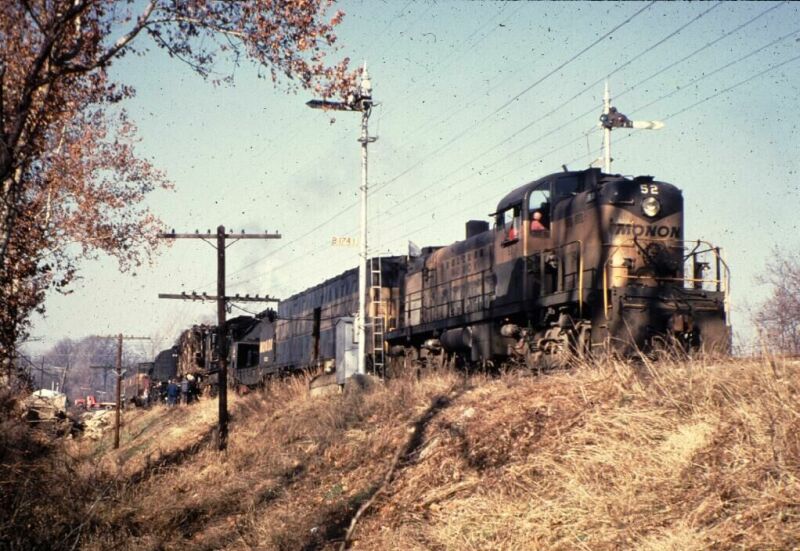
Side view of the wreck train at Nora, near 75th Street.
Nora 2006
Left: Looking south along the former right of way from a location about 500 yards north of 86th Street. Right: Old telephone building north of 86th at Nora.
Left: Concrete base of a signal along the right of way. This base is about 5 feet south of the telephone shack. Right: Looking to the north along the former right of way from 86th Street.
Left: Looking south along the former right of way at 86th Street. Right: Another view looking south along the old right of way. This location is about 600-700 yards south of 86th Street.
Left: Looking north along the former right of way towards 86th Street. Right: Old ties from a siding or passing siding still in place east of the mainline. This location is to the east of where the left photo was taken. It looks like there was a passing siding at one time. Nora area 2020 Pictures by Nathan
Miles
MP B 175.3 2nd Subdivision - Bo
As early as 1821, pioneers began settling the area near the present site of Broad Ripple. Yet it was not until 1837 that people started coming to the area in great numbers. In late 1836 or early 1837, construction began on the Indianapolis link of the Central Canal, one of the many projects in canal building which followed the completion of the great Erie Canal in 1825. The town of Broad Ripple was established on the banks of the White River in 1836 by Jacob Coil. One year later construction of the Canal began. The town of Wellington was platted on the south side of the canal. In 1884 Wellington became part of Broad Ripple. In 1922 the town of Broad Ripple was annexed into Indianapolis. -"History Of Broad Ripple" Broad Ripple High School 1967, Courtesy Broadripplehistory.com -
Broad Ripple Park had its beginning when Jonas Huffman received a 60.05 acre tract of land north of Indianapolis from the United States government on September 16, 1822. In 1907, the park became the great amusement center known as White City when the White City Company of Indianapolis, owned by W. H. Tabb and Dr. Robert C. Light, leased the park for nine years. The park was given the nickname of Broad Ripple Park since it was located on the outskirts of that community, and about 100 people from the village were employed there. The White City company added many facilities to the park, giving it the appearance of Coney Island. A Venetian canal, a fire show, a scenic railroad, an 80'x 100' concrete Natatorium or pool, and an open circus were located on the northeast side of the park. Amusements in the east section of the City included the "bump-the-bump," bowling alleys, the "Johnstown Flood," the Theaters of Paris, carousels, and other midway rides. One of the unique features of White City was the exhibit in which white horses jumped from an elevated platform into a tank of water. -"History Of Broad Ripple" Broad Ripple High School 1967, Courtesy Broadripplehistory.com -
Left: Broad Ripple Park as it was in its heyday during the early 1900's. In the background is the park's gigantic roller coaster. On the right is the "chute," one of the park's main amusements. Miniature boats slid down the ramp and ended up in the lagoon below. Right: Midway of Broad Ripple Park as it looked in the 1930's. On the left of the roller coaster, added to the park in 1922. One of the most fascinating midway features was the "dodge'em" shown in the center of the picture. -"History Of Broad Ripple" Broad Ripple High School 1967, Courtesy Broadripplehistory.com -
Broad Ripple, circa 1917. Left: Monon mainline looking north. Right: Looking to the southeast (railroad south). The LNA&C (Louisville, New Albany & Chicago) finished grading the line at Broad Ripple in February 1882. This left the line less than 10 miles from Indianapolis. Rails were pushed through Broad Ripple and Howlands (between Broad Ripple and Boulevard Station.) linking to the Lake Erie & Western. A depot at Broad Ripple was first established in 1894. Broad Ripple area 2022 Pictures by Nathan
Miles
Br 178.4 -2nd Subdivision-
Original bridge over the White River in Broad Ripple. Photo was taken in 1901.
Left: North end of the White River bridge. Engineering dept poses for a picture. Right: North approach to the White River bridge.
White River Bridge, circa 1987. Left: South end of White River Bridge, looking north. Winston Island Woods condos now occupy far right shore area. Right: Side view of the White River Bridge.
Williams Creek Connector Bridge, circa 1987. Left: Side view of the Williams Creek Connector Bridge. Right: Standing at north end of Williams Creek Connector Bridge, looking south.
Broad Ripple, Indiana. Left: Looking at the former White River bridge, now part of the Monon Trail. Right: Standing in the center of the bridge.
Left: Former right of way, probably south of White River. Right: Standing at 65th Street, looking north past railroad car that still sits there.
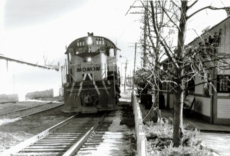
Northbound freight, with C-420 #503 in the lead passing the former Broad Ripple Depot.
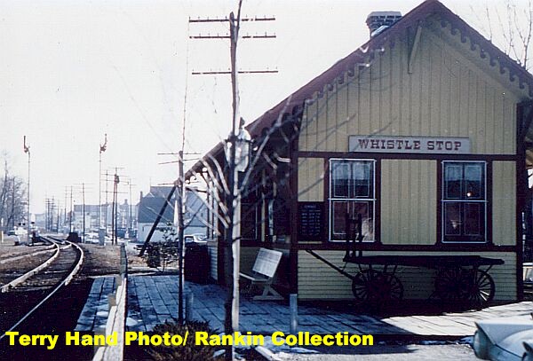
Broad Ripple Depot. -MRHTS Photo Archives-
Left: Broad Ripple Depot, date unknown. Looking south. Right: Broad Ripple 2004. The depot and former mainline are now part of a walking trail.
Left: Mainline looking north at Broad Ripple. Note cabooses to the left of the picture. Not sure if they were Monon or not. Right: Mainline looking south.
Left and Right: Looking north along the right of way at Broad Ripple. -MRHTS Photo Archives Collection-
Looking south along the mainline near milepost B177. The switch leads into the Shelhorn Company.
MP B 178.5 2nd Subdivision - Monon management came to understand that the Indianapolis branch's only real potential was as a passenger line. In 1922 Boulevard Station was constructed to serve the north side of Indianapolis as well as the State Fair Ground, which were just east of the tracks at 38th Street. The station boasted floral displays, adequate parking and for many years a house track for Pullman cars that were part of the Mid-night Special.
Northbound special at Boulevard Station, late 1930's. This excursion was on its way to Michigan City, Indiana. Courtesy Steve Dolzall.
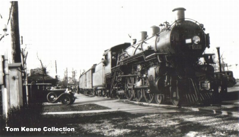
Southbound making a station stop at Boulevard Station. Locomotive #431 in the lead. No date listed.
Southbound Hoosier making a stop at Boulevard Station. Unknown date.
Boulevard Station. Left: August 23, 1953. Note the presence of vehicles in the parking lot. Right: Boulevard Station, another look, date unknown. Looking north.
Left: May 1959. Train #11 making a stop at Boulevard Station. Right: The Hoosier , Train #14, running alonside the Indiana State Fairgrounds on the northside of Indianapolis.
Southbound arriving at Boulevard Station. August 23, 1953. -Courtesy Steve Dolzall-
Boulevard Station, early 1960's.
Northbound Hoosier about to cross 38th Street and will soon glide to a stop at the depot. -MRHTS Photo Archives Collection-
Northbound freight on the Air Line approaching 38th Street, late 1960s, early 1970's.
Boulevard Station 2006
Boulevard Depot, circa 2006. Left: Looking at the north and east walls. You are looking to the southwest. Right: Look at the east wall of the depot.
Left: Back wall of the depot. Right: Shot from the former 38th Street crossing of the depot.
|


Return To Home | Contact Us | About Us @2004-2024 Monon Railroad Historical-Technical Society, Inc. All rights reserved.